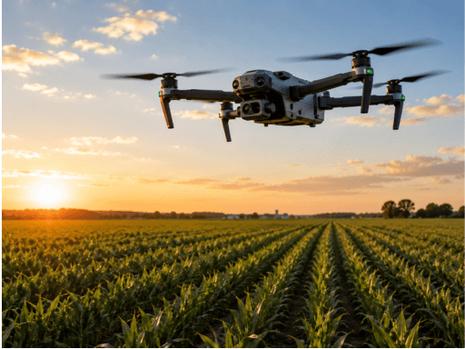
Why Skydio Mapping Drones Lead the Future of Inspection Technology

Xylos AI team
AI Research & Editorial
Inspection work has never been the easiest job. Someone has to climb structures, walk difficult terrain, get close to damaged equipment, and collect enough information for engineers to make a call. It can be slow, expensive, and sometimes downright dangerous. That’s why Skydio mapping drones are getting serious attention across industries that depend on accurate inspections.
These drones aren’t simply flying cameras. They combine autonomous flight, detailed imaging, mapping, and data collection in one system. That changes the way inspection teams approach a site. Instead of putting people in risky places just to get a closer look, teams can often send a drone first. It’s quicker, safer, and gives inspectors a much better view of what’s actually going on.
Why Traditional Inspection Methods Are Losing Ground
Traditional inspections still have their place. Nobody is saying otherwise. But there are obvious problems.
A worker inspecting a bridge, tower, roof, power structure, or industrial facility may need special equipment and safety procedures before the actual inspection even starts. There’s also the issue of access. Some areas are simply awkward to reach, and others can expose workers to unnecessary risks.
Then comes documentation.
Photos taken from different angles, handwritten notes, measurements, and separate inspection reports can create a messy pile of information. If the team needs to compare the same structure six months later, finding exactly the right reference point can be harder than it should be.
Modern drone mapping helps clean up that process.
Autonomous Mapping Makes Inspections Smarter
One of the biggest advantages of Skydio mapping drones is autonomous flight. The drone can navigate complex environments while avoiding obstacles and maintaining a planned flight path. That matters when the inspection area is large or difficult to reach manually.
Instead of relying entirely on an operator to control every movement, autonomous technology can handle much of the flying. The operator can focus more on the inspection itself and less on constantly adjusting the aircraft.
That doesn’t mean the human is removed from the process. Quite the opposite. Skilled inspectors still decide what matters, review the imagery, and interpret the findings. The drone simply handles a lot of the tedious work.
And that’s where the technology starts making real financial sense.
Better Data, Not Just Better Pictures
A drone taking nice photos is useful. A drone producing structured inspection data is much more valuable.
Mapping technology can create detailed visual records of assets and sites, helping teams identify cracks, corrosion, surface damage, changes in condition, or other issues. With repeatable flight paths and consistent data collection, inspectors can compare current conditions with previous inspections.
That repeatability is a big deal.
If an asset is inspected every year, the goal isn’t just to collect another batch of random photographs. Teams want to understand what has changed. Has a crack grown? Has corrosion spread? Is a section of infrastructure deteriorating faster than expected?
Skydio mapping drones can support this kind of repeatable inspection workflow, giving businesses a stronger foundation for maintenance decisions.
Safety Is Still the Biggest Argument
There’s a simple reason drones have become so important in inspection technology: people shouldn’t have to take unnecessary risks for a photograph.
High-rise structures, transmission lines, construction sites, mines, bridges, and industrial plants can all present serious hazards. A drone can get close to areas that would otherwise require scaffolding, lifts, ropes, or long hours of manual access.
Security Drones also fit into this wider shift toward remote monitoring. While inspection and security are different jobs, both benefit from the same basic idea: gather useful information from a safe distance.
For businesses, fewer people exposed to hazardous environments can mean fewer accidents and less disruption. That’s not flashy. It’s just practical.
Where Drone Inspection Is Heading Next
The next stage won’t be about drones simply replacing inspection workers. That’s an oversimplification.
The bigger change is likely to be the combination of drones, artificial intelligence, mapping software, and inspection platforms. Imagine a drone collecting thousands of images while software helps flag areas that deserve closer attention. An engineer then reviews those findings instead of manually searching through every image.
That can save hours.
Industries such as energy, construction, infrastructure, telecommunications, mining, and utilities are already looking for ways to inspect more assets without constantly increasing inspection costs. Autonomous aerial systems give them another option.
As regulations, software, sensors, and processing capabilities continue to improve, drone inspections should become more routine. Eventually, sending a drone to inspect an asset may feel as normal as sending a technician with a toolbox.
Why This Technology Has Staying Power
There are plenty of drones on the market. Not every one is built for serious inspection work.
The appeal of Skydio mapping drones comes from bringing autonomous navigation and mapping into a workflow that is actually useful for professional teams. The combination reduces some of the limitations that have traditionally made drone inspections difficult to scale.
And scale matters.
A company with hundreds of assets doesn’t just need one impressive inspection. It needs a repeatable system. It needs consistent data, safer operations, and information that can be used by people who weren’t physically standing at the site.
Security Drones are also likely to become part of broader aerial data strategies, especially where inspection, monitoring, and site awareness overlap.
Conclusion: The Future Is More Remote and More Data-Driven
Inspection technology is moving away from slow, manual processes and toward systems that are safer, repeatable, and built around better data. Skydio mapping drones sit right in the middle of that shift.
They don’t eliminate the need for experienced inspectors. They give those inspectors better tools.
That distinction matters. The future isn’t about putting a drone in the air and hoping it solves everything. It’s about combining autonomous flight, detailed mapping, human expertise, and useful analytics to make inspection work less dangerous and more efficient.
As infrastructure gets older and inspection demands continue to grow, that approach is going to matter even more. Security Drones, mapping platforms, and autonomous inspection systems are becoming part of a bigger change in how businesses understand their physical assets.
The technology still has room to improve. Of course it does. But the direction is pretty clear: fewer people taking unnecessary risks, better information coming back from the field, and inspection decisions based on actual data instead of guesswork. That’s a future worth building.
Stay Ahead of the Curve
Join 12,000+ top strategists getting weekly human-curated editorial insights and deep-dives directly in their inbox.