How Accurate Is Drone Mapping? What Businesses Need to Know

Xylos AI team
AI Research & Editorial
Drone mapping has changed the way a lot of businesses collect information about land, buildings, construction sites, and large work areas. Instead of sending survey teams across difficult ground for days, a drone can capture hundreds, sometimes thousands, of images in a much shorter time. But there’s still one question that comes up often: how accurate is it, really?
The answer isn’t simply “very accurate.” It depends on the drone, camera, flight planning, weather, software, and how the data is being checked. A good drone mapping job can produce highly detailed measurements. A badly planned one can produce a nice-looking map that isn’t reliable enough for serious work. That difference matters.
What Makes Drone Mapping Accurate?
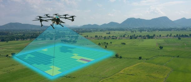
At its core, drone mapping works by capturing overlapping aerial images and processing them through specialist mapping software. The software identifies common points between images and uses them to create a detailed 2D map, 3D model, point cloud, or orthomosaic.
The accuracy of these outputs depends heavily on the quality of the images.
Flight height is one factor. Flying lower generally gives the camera more detail, although it also means covering less ground per flight. Camera quality matters too. A sharp, properly calibrated camera will give the mapping software more useful information to work with.
Then there’s overlap. If images don’t overlap enough, the software has less information to connect them properly. This can lead to gaps, distortions, or inaccurate measurements.
It sounds fairly simple, but small mistakes during the flight can add up.
How Accurate Can Aerial Mapping Be?
For many commercial applications, drone surveys can reach accuracy within a few centimetres when the right equipment and control methods are used. That’s a big reason drone surveying has become popular in construction, mining, agriculture, infrastructure, and land development.
But centimetre-level accuracy shouldn’t be treated as an automatic guarantee.
Ground control points, or GCPs, can be placed around a site at known coordinates. These points give the mapping software real-world reference locations, helping it position the final survey more accurately.
Some modern systems also use RTK or PPK technology. These positioning methods can significantly improve the drone’s location data while it is collecting images. For projects where measurements really matter, this can make a noticeable difference.
Without these controls, a map may still be useful, but its absolute accuracy could be lower.
Relative Accuracy vs Absolute Accuracy
This is something businesses sometimes overlook.
Relative accuracy refers to how accurately objects are positioned compared with each other. For example, a stockpile might be measured consistently from one point to another, even if the entire model is slightly shifted from its actual geographical position.
Absolute accuracy is different. It means the data lines up correctly with its real-world coordinates.
For some projects, relative accuracy is enough. For others, especially engineering, construction, and property-related work, absolute positioning is much more important.
Knowing which one a project actually requires can save a business time and money.
What Can Affect Drone Survey Accuracy?
Weather is an obvious one, but it gets underestimated.
Strong wind can make it harder for a drone to follow its planned flight path. Rain can affect equipment and image quality, while harsh sunlight can create shadows that make certain features harder for mapping software to identify.
The site itself can also cause problems. Tall trees, reflective surfaces, moving vehicles, water, and dense vegetation may all create complications.
Then there’s the person operating the equipment. Automated flight planning helps, but it doesn’t remove the need for proper surveying knowledge. Someone still has to choose the right flight height, overlap, camera settings, control points, and processing method.
That’s why simply owning a good drone doesn’t automatically make someone a good survey provider.
Where Surveying Drones Make the Most Sense
Surveying Drones are particularly useful where traditional surveying would take a lot of time or expose workers to unnecessary risks.
Construction companies can use aerial data to monitor progress, compare completed work against plans, and calculate volumes. Mining operations can map stockpiles and large areas without sending teams into difficult locations.
Agricultural businesses can also use aerial imagery to understand crop conditions and spot changes across large fields. Land developers, engineers, and infrastructure companies have their own uses for the same technology.
The common thread is speed and access. A drone can collect information from areas that may be awkward, dangerous, or simply expensive to survey manually.
That doesn’t mean traditional surveying is obsolete. It isn’t. For boundary work, legal surveys, and projects requiring specific professional certification, a qualified land surveyor may still be necessary.
Is Drone Mapping Accurate Enough for Business Decisions?
In many cases, yes. But businesses should start with the required level of accuracy, rather than buying into the idea that newer technology is always better.
A basic aerial map might be perfectly suitable for planning and visual reporting. A construction project requiring precise measurements may need RTK or PPK equipment, ground control, and professional survey-grade processing.
The important thing is matching the technology to the job.
It’s also worth asking how the final data will be delivered. A point cloud, orthomosaic, contour map, digital surface model, and 3D model all have different uses. Getting the wrong output can be almost as frustrating as getting inaccurate data.
Conclusion
Drone mapping can be extremely accurate, but accuracy comes from the whole process, not just the aircraft flying overhead. Good equipment helps. So does careful flight planning, reliable positioning, ground control, suitable weather, and proper data processing.
For businesses, the smarter approach is to decide what level of accuracy the project actually needs before choosing a drone survey method. Surveying Drones can save considerable time and make large or difficult sites much easier to document, but they still need to be used properly.
The technology is impressive, sure. But the real value comes from getting dependable data that a business can actually use. That’s where accurate drone surveying earns its place.
Stay Ahead of the Curve
Join 12,000+ top strategists getting weekly human-curated editorial insights and deep-dives directly in their inbox.